


Situated near the old entrance, the Town Hall was rebuilt in 1700 by the architect Capponi from Cupramontana.
The facade has a portico with four arches. A staircase with an elegant travertine balustrade leads to the first floor which houses the mayor’s office and the council hall. Four medallions are displayed in the high ceiling, representing the symbols of the Savoy’s, Provincial, District and Municipal Arms (a lion rampant within a floral wreath).
Here you can admire other decorations enhancing the scenic art and four medallions representing the Italian poets of the Golden Age.
Attached to it, you will find the stage once used for performances of companies and jugglers.
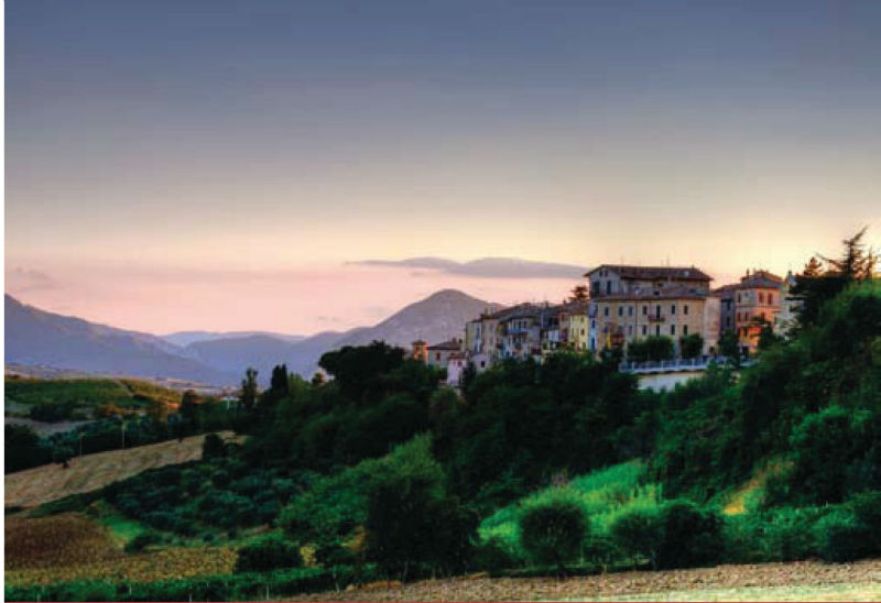
Maiolati stands on a hill 412 meters above sea level.
It dates back to the Midddle Ages, like the other castles of the middle valley of the River Esino.
In the thirteenth century Maiolati and Villa Talliano, situated in the middle of the hill that slopes into the River Esino, were two small villages located at a short distance from one another.
Thanks to its position, Maiolati became soon a castrum; it was part of the County of Jesi from the first decades of the thirteenth century until its dissolution in 1808. Like many other villas in Vallesina, Villa Talliano was built after the eleventh century as an extension of a curtis, that is a complex of dispersed landed properties. It belonged to the bishop of Jesi and was contended from Jesi in 1262 which then acquired all rights.
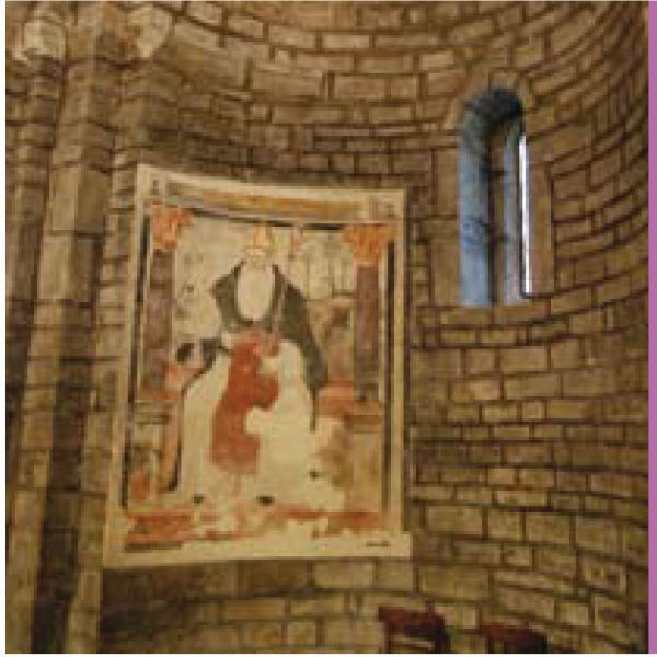
Not far away, take a gander inside the church of Saint Sisto of Talliano with the attached cloister.
The church and monastery were probably founded by the monks coming from St. Elena Abbey; in fact they both belonged to it in 1199.
In 1305 they both suffered severe damages because of the struggle between Jesi and the inhabitants of Fabriano.
The church of St. Sisto now standing in place of the monastery was probably rebuilt in the XVIII-XIX centuries. Visit the remains from Neolithic and Roman ages found in this area, more exactly in Massarella Street on the east side of Maiolati.
In the period from the seventh to the ninth century, the whole ridge was the border area between the Longobard Duchy of Spoleto and Camerino and the Byzantine Pentapolis. Many of the “loci dominus” have a Longobard origin and they were later put to the head of the fortified villages and castles.
Distance: km 21
Time advised: 3 hours (on foot); an hour (by car)
Difficulty: easy
Starting from Santa Maria alle Moie Abbey, follow the road towards San Sisto and visit its Abbey; cross Scisciano Bridge and have a look at Mill Marcelletti in Scisciano. Then go on your way towards Maiolati Spontini .
A walk here allows you to experience a contact with a world of history and culture (Scisciano and Maiolati castles); of spirituality (Santa Maria alle Moie Abbey, San Sisto Abbey, the rural churches of Santa Liberata and San Pietro); as well as with a natural world and an amazing landscape, a patchwork of vineyards and olive-groves.
Going downhill back to Moie along the so-called Boccolina, do not forget to visit the small rural church of San Pietro at the bottom of it.


Castelli del Verdicchio - cookie policy - credits
Tel. +39 0731778710
Fax. +39 0731778750
Via Nazario Sauro, 1
60034 Cupramontana (AN)
| |